Maps Page on Italy
Outline
1. Physical Environment
o Physical map with cities
o Terrain relief map
o Italian Provinces
2. Weather & Climate
o Climate of Italy
o Precipitation Map
o Average temperature
3. Human Environment
o Population density
o Average GDP per capita map
o Political party map
4. Road maps
o Major highways and large cities
o Train route map
o Canal map of Venice
5. City Maps
o Map of Rome
o Map of Bologna
o Map of Naples
6. Urban Transportation Maps
o Rome’s public transportation layout
o Venice water bus map
o Public transportation systems of Italy
7. Tourist Maps
o Map of the Vatican City
o Map of Savona, Italy
o Closer look at Tuscany
1 Physical Environment
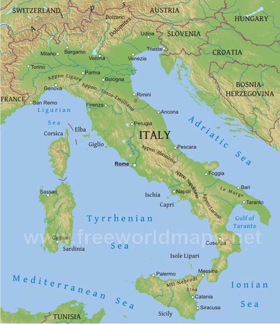
Physical map of Italy with large cities.
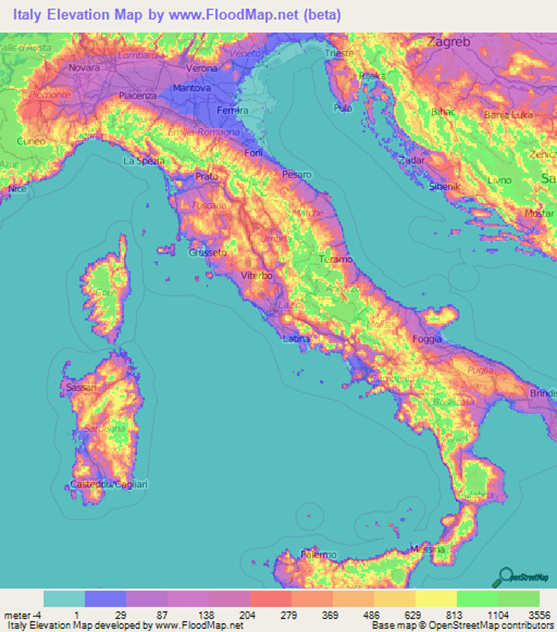
Detailed terrain relief map of Italy.
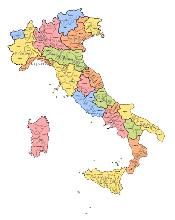
Map of Italian provinces.
2 Weather & Climate
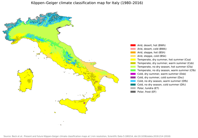
Average climate map of Italy.
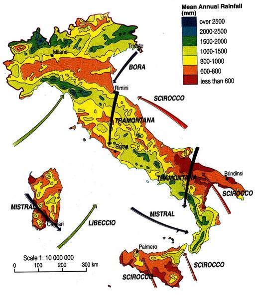
Mean annual rainfall map of Italian regions with usual wind directions.
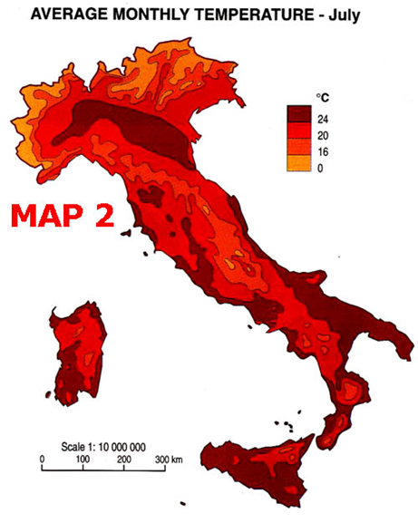
Average temperature of Italian regions in July.
3 Human Environment
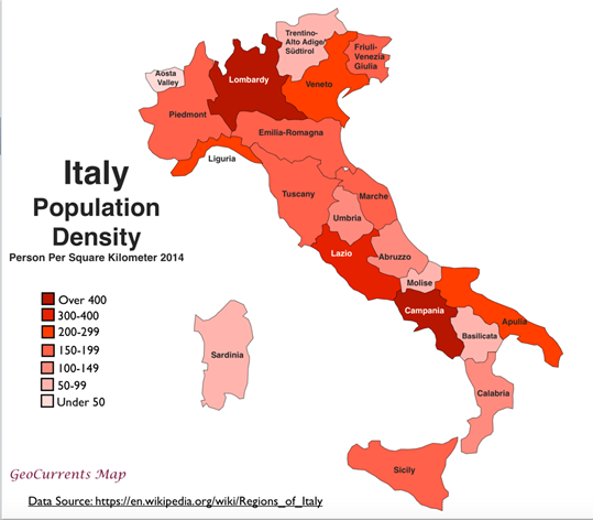
Population density of each province.
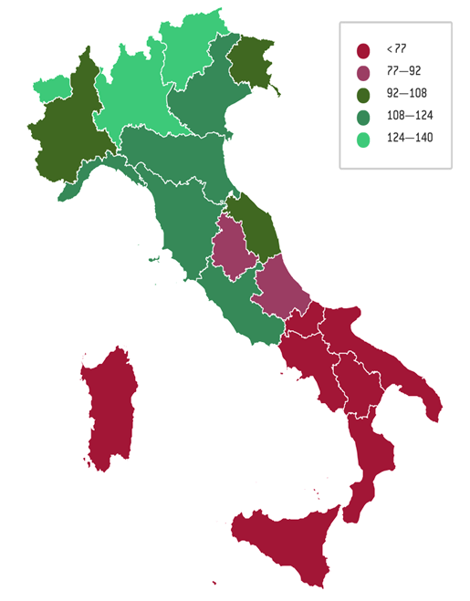
Average GDP per capita separated by province.
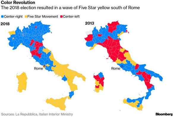
Recent political movement maps of Italy.
4 Road Maps
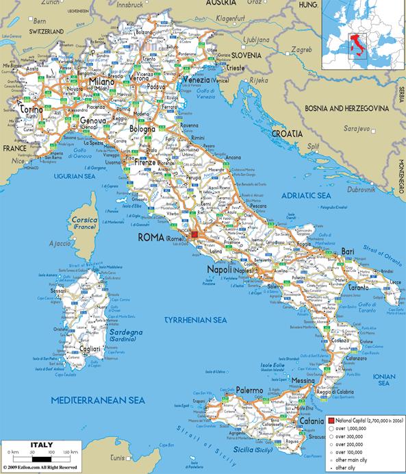
Major roadway map of Italy included with cities and city sizes.
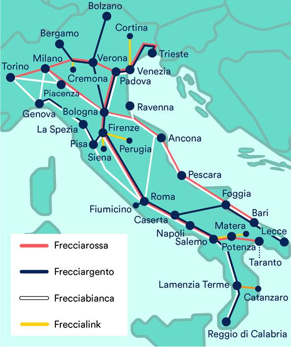
Map with all of the train routes in Italy.
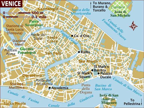
Canal map of Venice.
5 City Maps
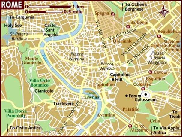
Map of Rome.
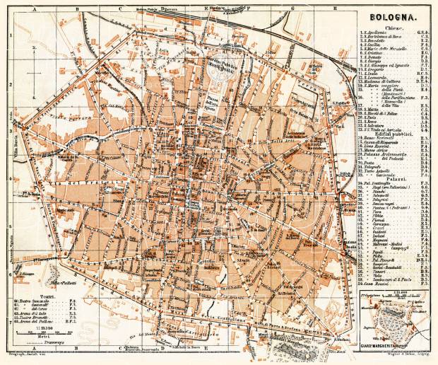
Map of Bologna.
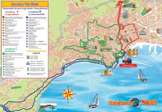
Map of Naples.
6 Urban Transportation
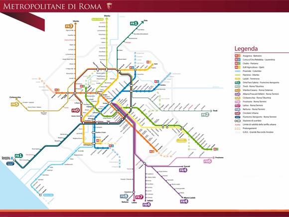
Rome’s public transportation layout.
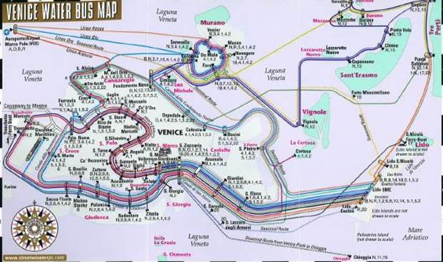
Venice water bus map.
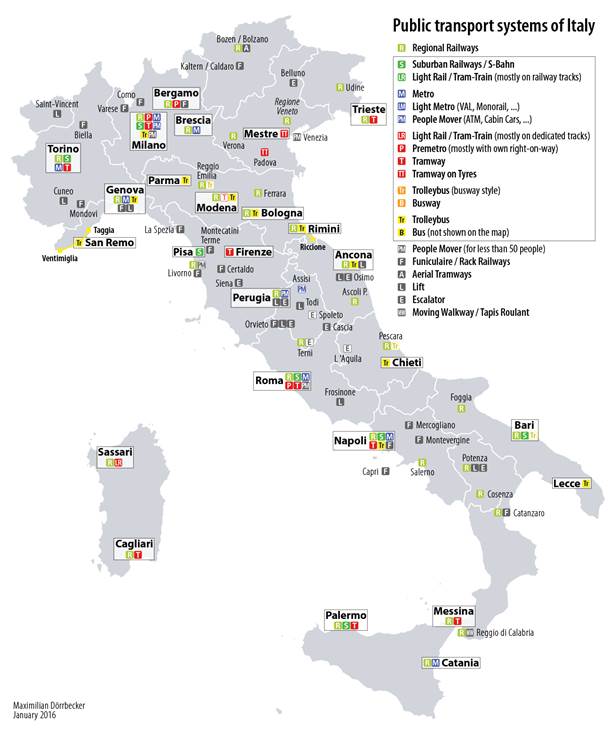
Public transportation systems of Italy
7 Tourist Sites
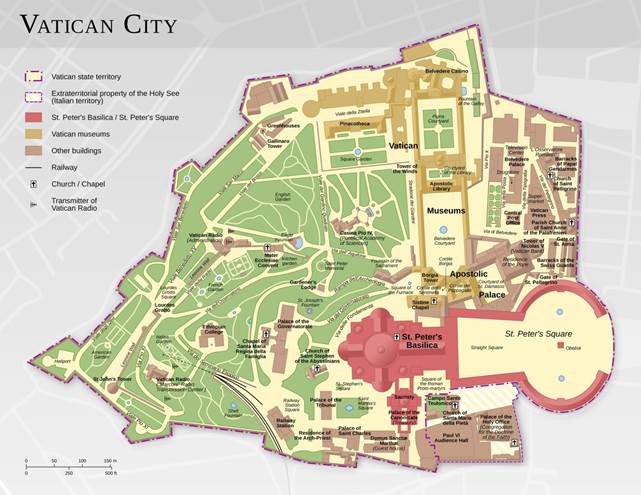
Map of the Vatican City.
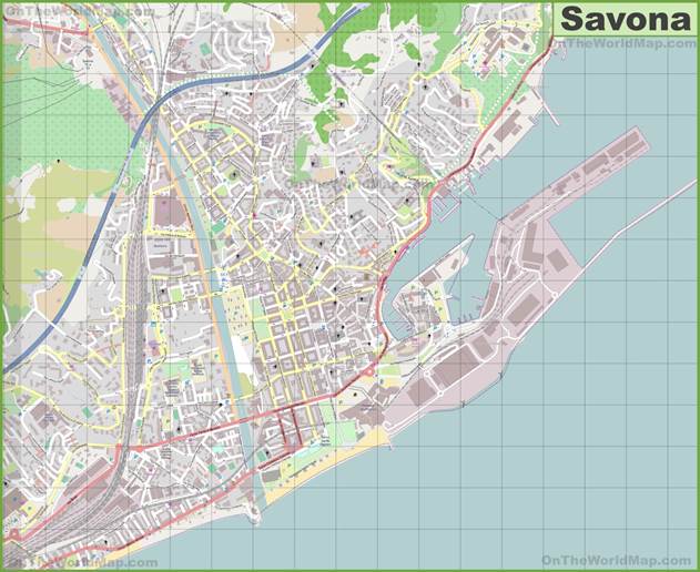
Map of Savona, Italy.
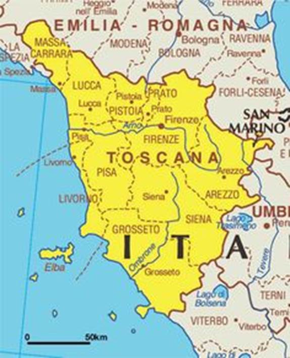
Closer look at Tuscany.
Submitted by Dan Pavlik on 3/4/19.